Hiking 100 miles alone on the Cape Wrath Trail
If you are planning on getting into wild camping or being outdoors more (or you already are out there, awesome!), take care to follow Leave No Trace rules to keep the wilderness wild.
The Cape Wrath Trail is a ~240 mile mini thru hike crossing the mountains and circling the lochs of north west Scotland. While it has “trail” in the title, there is no such official route; rather the CWT is a collection of tracks, paths and unmarked ways which walkers thread together, however they choose, to chart their own course from Fort William to Cape Wrath, at the north-westernmost point of the UK mainland (or the reverse if you decide to do it southbound).
Eagle-eyed viewers will note that the title of this piece says “100 miles”, not the full distance of 240. Sadly, Achilles Tendonitis meant I had to bail out half way through. While this was a real disappointment to me, avoiding surgery was the right call. I still had an incredible time, and fully intend to restart and complete the trail this time next year.
As always, I am writing this trip report mainly for my own benefit, but maybe someone else will find it useful :)
0: Starting
The month before my trip, April 2021, both England and Scotland had exceptionally good weather. So good, that I spent the 2 weeks leading up to May 8th obsessively checking weather reports, waiting for my luck to run out; like there was a quota for these sorts of conditions which had to be filled by now. Sure enough, a couple of days before I left it snowed in Scotland. There was a lot of noise in the news about it,all this heavy snow in May, even though it wasn’t wildly unusual.
While it didn’t change my plans, it could have affected how I approached the trail and what I took with me. Would I need warmer clothes? More of them? Would snow or ice make sections of already unforgiving terrain more dangerous or taxing? Would I need microspikes for my boots? Would it slow me down? How dangerous, or even possible, would river crossings be with potential snow-melt?
My most pressing concerns were timing and weight. The standard range of completion for most walkers on this trail is 16 to 28 days. I was aiming for 14-16 days. This meant long days starting at 6am and dropping at 7pm or later to cover as much mileage as possible. If this sounds tough, it’s not really… if you pack right.
There is a whole discipline in hiking called “ultralighting”. The idea is simple: if you carry less you can do more. Honestly it is kindof an obsession, the sort of thing which has you repeatedly weighing individual tent stakes, or cutting your toothbrush in half, in order to find the odd gram to shave off. It sounds ridiculous, but those couple of grams here and there do add up. Ultralighters sometimes spend months crafting their gearlists, gradually whittling away at luxury items (“Do I really need a clean pair of socks each day?”, answer: no), until all they have is what they need to survive.
Anyway, through experience and trial-and-error and, yes, obsession, my pack is light. I am not quite ultralight yet, but my shoulder-season base weight of 7kg is pretty good. Good enough that my target of 15 days was entirely possible. Unless it snowed.
I decided in the end to ignore it and carry on with everything as planned. The snow had fallen mainly in central and eastern Scotland, over the Cairngorms, and I was going to be in the west. The first couple of days I would be in the lowlands, and I had read that a high-pressure front was on the way. So I reasoned that any snow on the hilltops would be long-gone by the time I got there. My only quilt is rated at -18 celsius, so I would be fine with the one set of spring clothes I had planned. I threw my microspikes in the car so I could see what things looked like as I drove to the start, but hoped I wouldn’t need to use them.
I am now quite used to driving from the south of England to Scotland, so the 10 or so hours go by comfortably. I leave London at around 5am and arrive at my spot outside the Premier Inn in Fort William just before 4pm.
It rains pretty much the whole length of the country, with some flurries of snow which settled fast as I drive into Cumbria on the A66, always my favourite road of the journey. But Fort William it seems is the only sunny and windless place in the UK today, which means I get to start my journey warm and dry.
To get to the official start of the trail, you have to take a ferry across Loch Linnhe to Camusnagaul. I get there a little early for the last crossing of the day, just as I spot some ominous looking clouds behind the snow-capped peaks of Ben Nevis. Fortunately the captain drives up while I am looking off the pier for a typical ferry. He says I am welcome to go aboard early and wait, and points down a small slipway to the right to a very small craft which I had completely overlooked.
The ride only takes about 10 minutes, and costs me a very reasonable £2 (cash only). I am sharing the tiny boat with three bikepackers, a young guy I take to be a local (he’s the only passenger in “street” clothes not high-tech outdoor gear) and the captain’s dog.
On the other side I thank the skipper and head south down a quiet country road which follows the beach of the loch. I think there is maybe 6 or 7 miles of road walking at this, the very first section of the CWT. It’s probably my least favourite bit of the trip. Honestly I am not sure why the official guides say to start at Camusnagaul. About 10 miles south of Fort William, reachable by bus, is the Corran Ferry which takes you to Ardgour. From Ardgour I would guess it is no more than 4 miles to Cona Glenn, so basically half the distance.
This is what I am muttering to myself as I trudge along the tarmac. Of course, it isn’t awful. It is still a nice walk on a sunny day along a peaceful loch with lots of deer watching me walk by in frozen silence. But road walks are boring, so I try to hitch. Not an easy thing to do in a pandemic on a country road which few would have any reason to be on. After about an hour’s walking, two cars pass me. The second stops, and four lovely hillwalkers squeeze up to make room for me.
They drop me off at Inverscaddle bay having saved me another hour of roadwalking. I follow the jeep track west along the valley of the Cona River. Once I am out of the trees and past a herd of Highland cattle, who have no interest in me whatsoever, the hills rise up on either side and I feel like the trail has really begun.
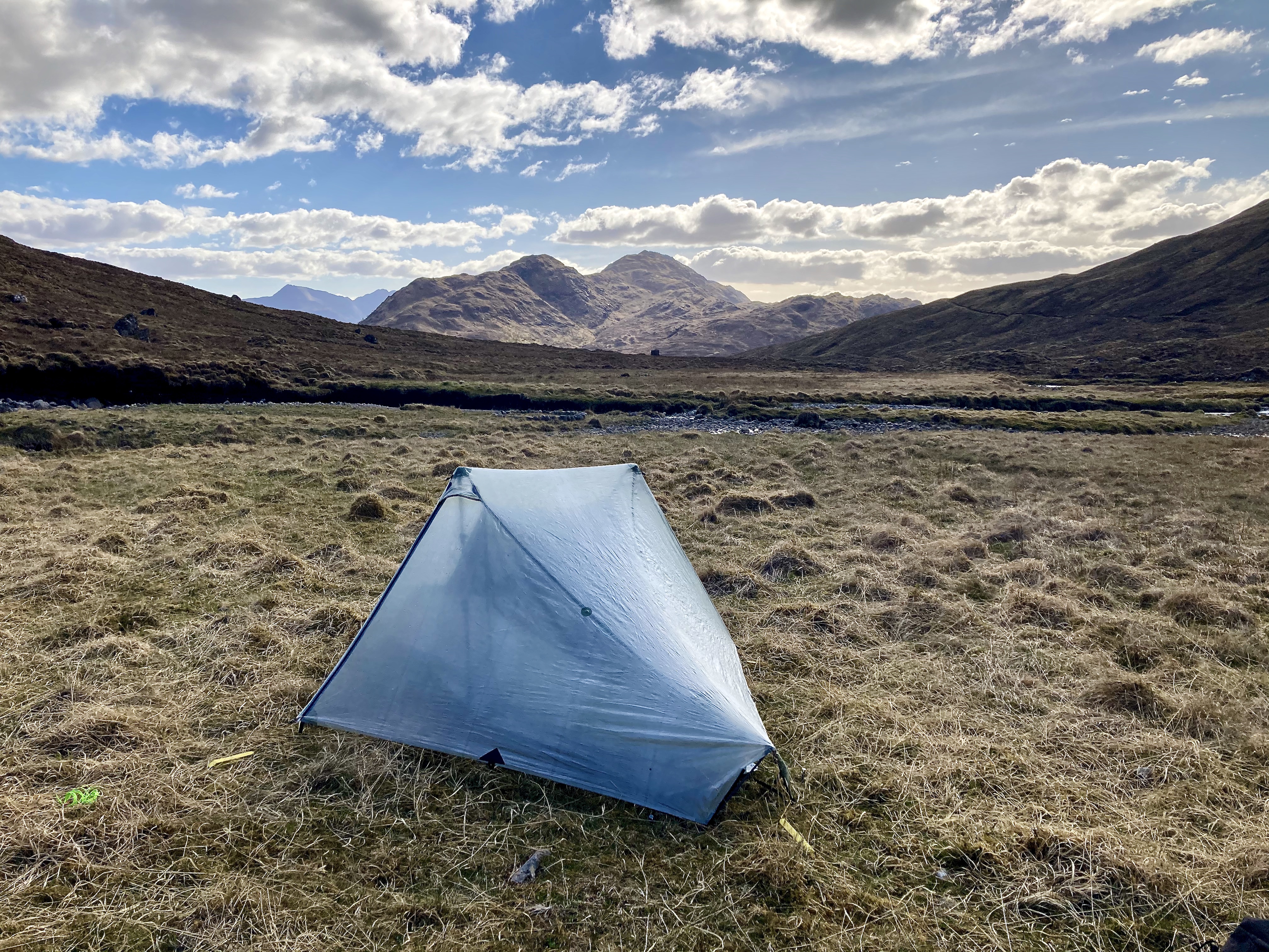
I walk until around 7.30pm, stopping when I get to Corrlarach bothy, a bit under 12 miles from the start of the trail. The bothy is locked, I knew it would be, so I pitch up just outside. I’ve seen a lot of deer in this valley, so my main thought when setting up camp is: “ticks, I bet there are ticks everywhere”. And sure enough I pull 2 off my toes. They are only small and haven’t attached yet, so it isn’t a big deal.
After negotiating the less-than-I-am-used-to space of my new shelter, I lie back and listen. The light wind occasionally brushes grass against the sides of the tent, and above the murmur of a low river, a cuckoo sings. The kind of silence you only really get when you are completely alone for miles.

1: High miles but low energy
I am up and gone by 7am my first full day. A little later than I would have liked, but I’m not feeling too great; despite sleeping well (or so I thought) I am kindof shaky the whole day.
My feet are also not brilliant. The hour on the road the day before had caused my new insoles to rub against the inside of my heels. I use gorilla tape to soften the edges and bind my feet in leukotape, hoping that would take care of it.
But the weather is nice and clear with some dramatic clouds. There is intermittent drizzle, but without any icy wind it’s refreshing rather than cutting.
The trail at this stage is pretty easy. The jeep track I was on the day before continues for another five miles, give or take, until the route switches to a narrower, but still clearly defined, path which takes me north up and over a pass, and then down into a valley following the Callop river. The climb isn’t much, barely 400 metres I think, but because I am not feeling well I find it way harder than I should. I have to stop every 10 paces or so, willing my stomach to not mess me about.
This valley leads down to Glenfinnan, home of the viaduct made (more) famous by the Hogwarts Express. On my way down I see the train puffing along, the steam joining with the mist rising off the forest and the low cloud rolling down from the hills.
The miles just before and beyond Glenfinnan are on yet more road. I will later meet some others on the trail who had chosen to start in Glenfinnan, cutting out the entire Camusnagaul and Cona Glenn section. Now that I plan to come back and do the CWT again, I intend to do the same as there is really nothing much to miss in that part.
Walking under the Glenfinnan Viaduct, I see an actual honest to god game of quidditch being played. Or at least I think I do. I also see big “film” cameras and microphone booms, so I guess maybe I will see myself walking by in the background of some low-budget HP themed movie one day. Who knows.
Finally, after what feels like a hundred miles of road walking, I reach Corryhully Bothy which is where I’d planned to break for lunch. I take a full hour to relax, eat, charge some stuff (there was electricity! In a bothy! Wild.) and do a quick tick check.
After lunch I continue to follow a jeep track as it rises gently towards the Allt N’Chaoruinn pass. At one point the river has swamped the road, and just as I am about to cross I spy a rickety bridge about 20 meters to my left which looks like it could be fun; I like a rickety bridge across a fast river. The track peters out and becomes a simple trail, but again, none of this section of trail is in any way difficult… unless you are feeling like absolute death. Around 5pm, after a couple of hours of excruciatingly slow progress, I lose most of my lunch. I start to feel a little delirious; when I get to the pass and saw the descent, I giggle uncontrollably for a good few minutes. I realise that with the weather turning colder and wetter, being ill and also fatigued from around 10 hours’ walking by that point, I am a good candidate for hypothermia. So I resolve to stop at the first viable campsite, even if it is right in the middle of the trail. (Normally I avoid this unless in an emergency as it is just not a nice thing to do.) I keep going long enough to cross the river at the recommended point; the guidebook marks that river as dangerous to ford in spate and I don’t want to get caught on the wrong side if it decides to tip it down overnight.
Not long after wading across I find a good-enough spot just far away enough from the trail and quickly dig in. I do my camp chores as fast as possible, and fall asleep before I have even clipped my quilt to the mat. I wake a couple of hours later, hearing a cuckoo close by, and force myself to stay up long enough to eat a hot meal before collapsing again.
Yet despite feeling terrible and my feet hurting from so many hours on concrete, I have managed a very respectable 17.6 miles. I’m not quite where I wanted to be, but am happy that I have even made it this far.
2: Beach weather
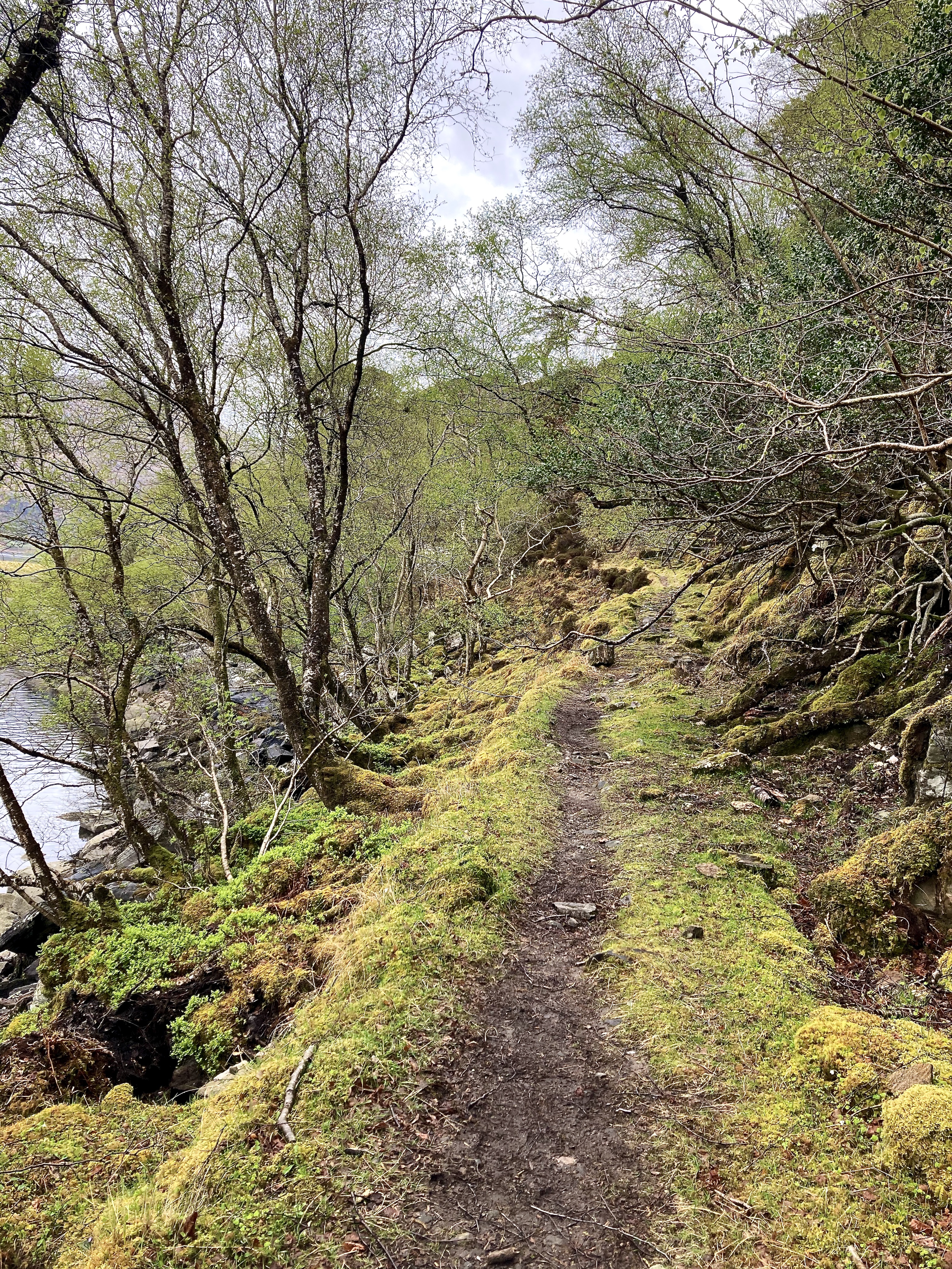
It rains lightly most of the night, but the skies clear just enough in time for me to break camp at 6.45. I continue down the faint trail, skipping over sections of bog, until I reach Glendessary forest.
The change is quite sudden. One moment you are out on marshland, with the sound of wind, rushing water and open skies. Then you step beneath the tress, and everything falls away. The canopy is dense and the ground damp and covered with mosses, scattered with fallen branches; the silence is spellbinding. The trees are planted in rows, the work of foresters over the last 50 years I would guess, but with everything overgrown and gnarled, the feel is ancient.
I squelch through the mud, my steps muffled and somehow at the same time too loud, until I duck under a fallen tree and emerge onto another jeep track. The sun is fully out by now and the air getting warmer. It starts to drizzle, and the sunlight makes the drops sparkle. My cuckoo is back, encouraging me to pick up the pace.
A few more miles in the forest and I arrive at A’chuil Bothy at around 9.30, just in time for breakfast. The bothy is down a steep path off the main track which is hard to spot unless you are looking for it. As I am weaving down through the trees I meet my first fellow Cape Wrath trailers; a couple who are just starting their day having spent the night at the bothy. At the bothy itself I meet another pair doing the trail, this time a father and son. They have gone the luxury route, and by the time I leave after my 30 minute breakfast break they are tucking in to some bacon sandwiches which make my high protein breakfast bar look very meagre.
Within 10 minutes of leaving the bothy I stop to strip off every warm layer. My standard base clothing is an insanely light pair of summer joggers and a UPF50 sun hoody. And this is why: 2 minutes of walking up the slightest of inclines, sun beating down (what the hell Scotland?) with no wind, and I am so uncomfortable. I hate walking in warm weather, and my toleration maxes out at ~10C when I am carrying a backpack up a hill.
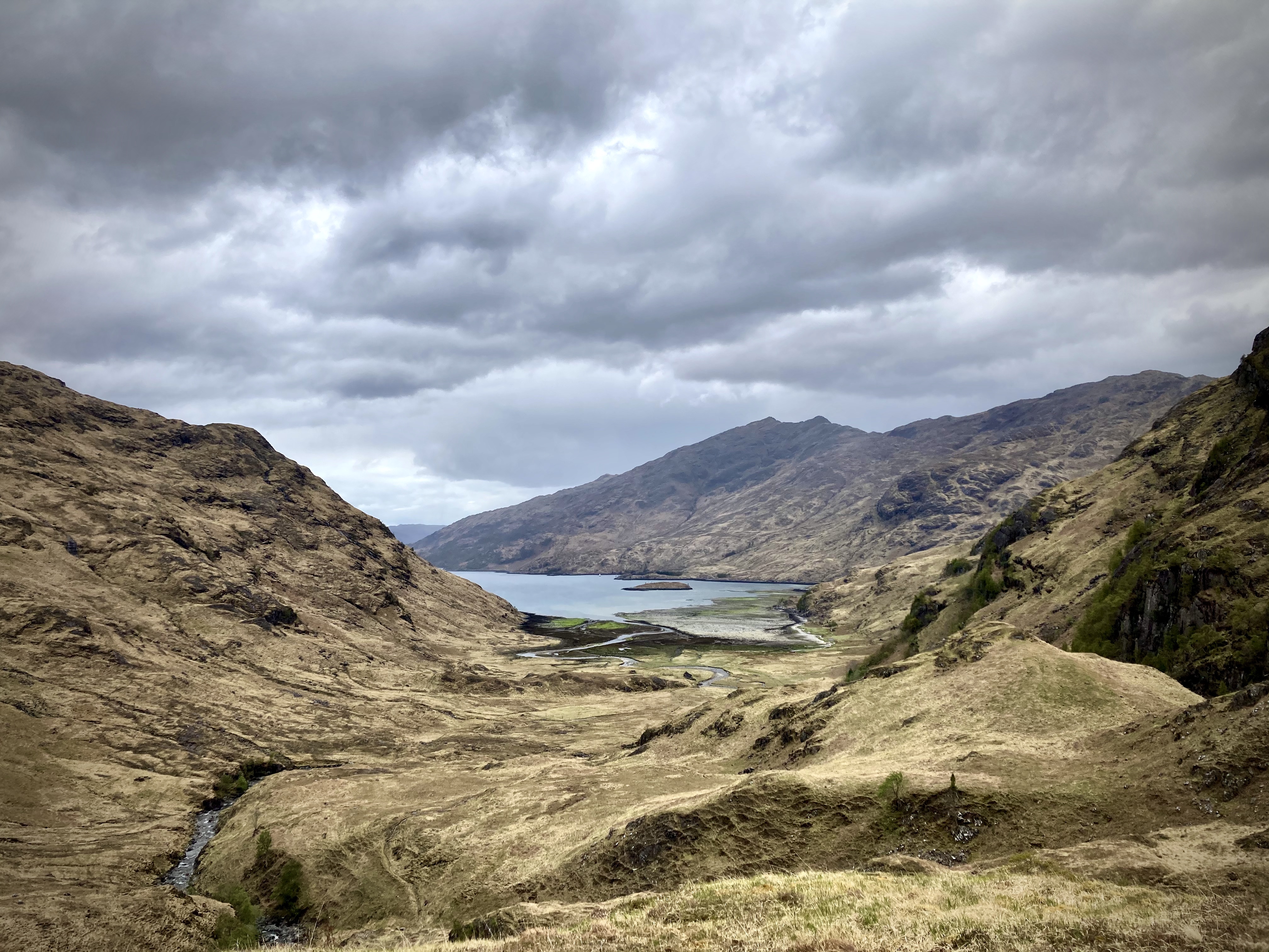
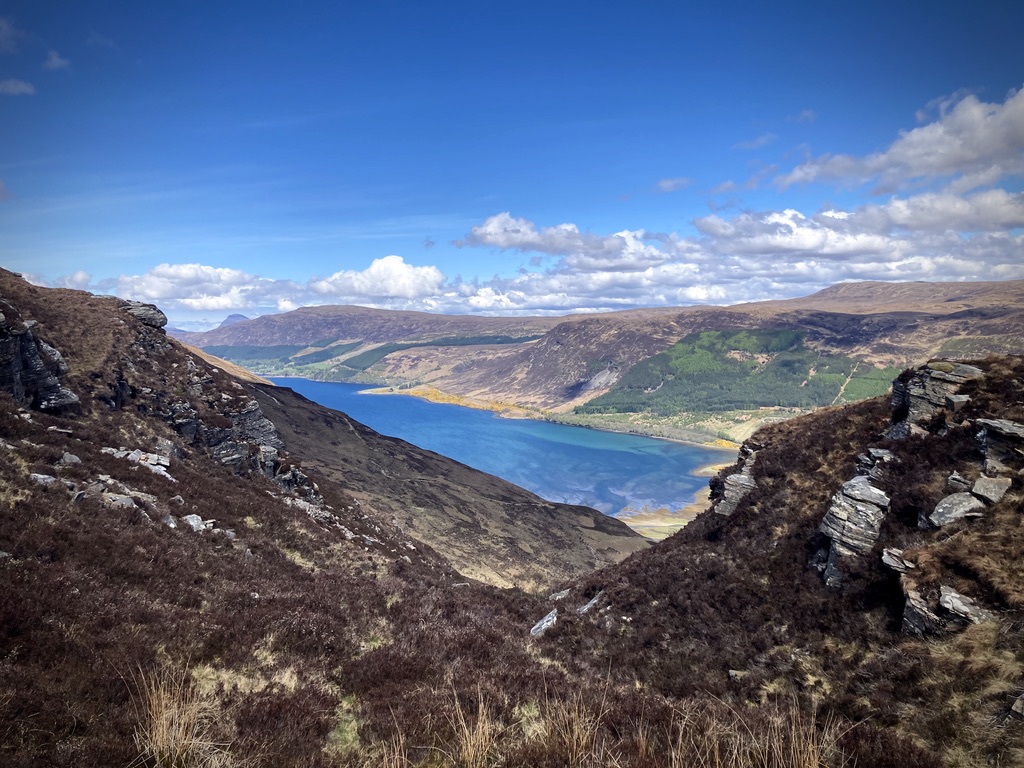
The route up to the An Lagain Duibh pass is lovely though, and I have many opportunities to take breaks by rivers and mountain lochans where I can cool off by sticking my head in the water. From just beyond Lochan A’Mhaim I catch a glimpse of my first sea loch, Loch Nevis, in the distance.
On the eastern shore of Loch Nevis is Sourlies; one of the most remote bothies in this most remote area of Knoydart, only reachable by foot or boat. I am making good time and intend to stop for lunch there.
The descent to the beach is pleasant and not too steep. There are plenty of deer around, on the slopes and gathered near the bothy, but by now the novelty has worn off some: deer are everywhere in these parts.
When I drop down to the sand, I watch as four kayakers drag their crafts up the beach some way before heading to the bothy. By the time I arrive there is a good crowd. Aside from the kayakers, there is the couple I had met earlier and another pair of guys also doing the trail.
At that moment the good weather breaks and we all duck inside the small shelter. After swapping stories and plans the party splits. The kayakers head back to sea in their warm waterproof gear, and the couple load back up and onto the trail. I give them enough of a head start so that we won’t have to be walking together if we don’t want to before I follow. The two guys left a little afterwards.
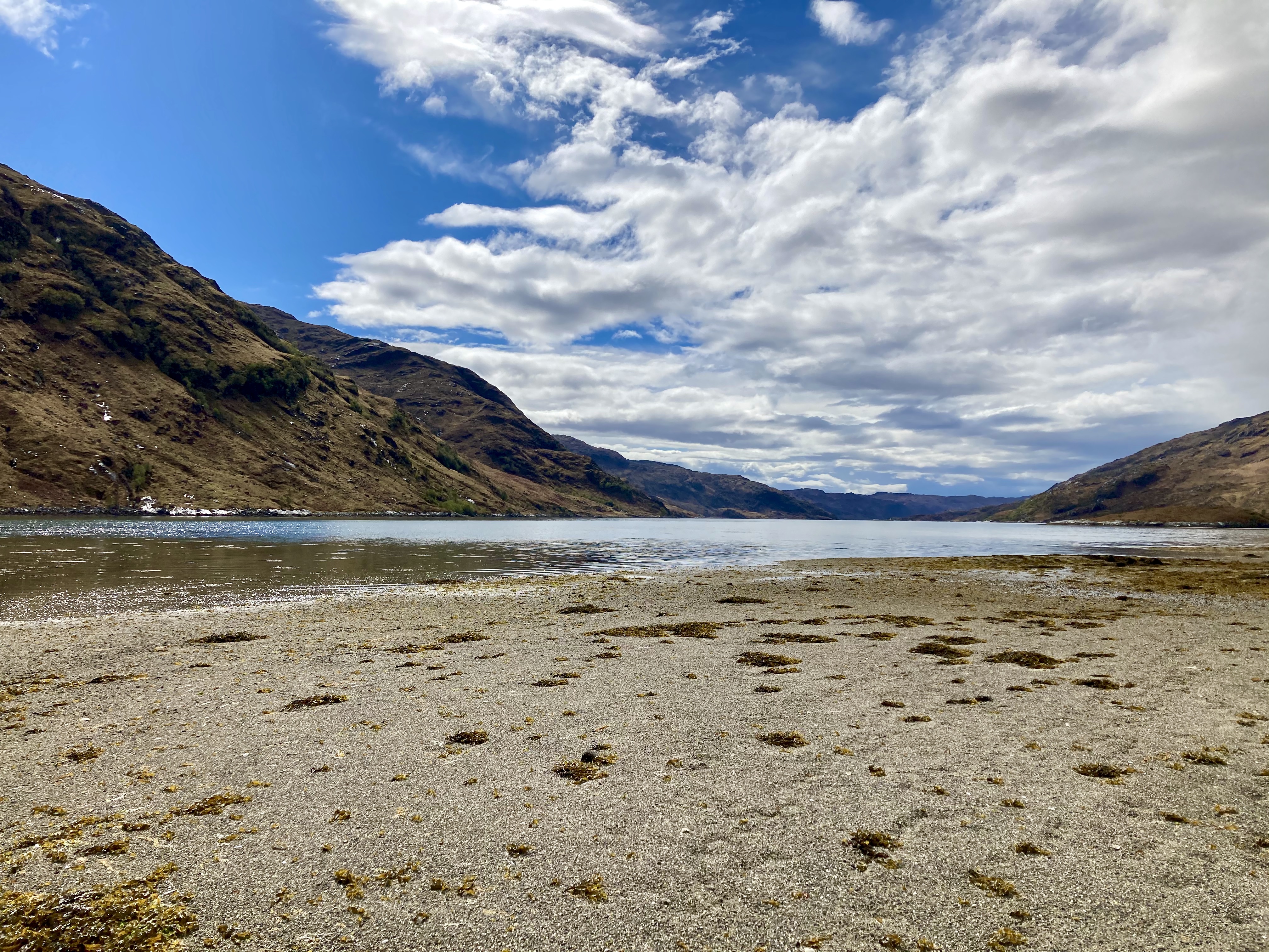
The tide is out, which means I am able to walk around the headland on the beach rather than clamber over the rocks on an unfollowable path. The sun is back and it is baking. On turning back inland I have to cross a wide expanse of flat marshland. There is no trail here, so each walker has to find their own way across to the river at the other end and the bridge over it. Half the fun is trying not to sink up to your shoulders in bog. With no wind, no shade, and the ground sucking at my feet with every step, it is a long and sweaty walk.
Once out of the marshes and across the river Carnach, the path vanishes here and there, but generally follows the curve of the river up into the gorge. The terrain gets steeper as the cliffs rise on either side, and there is a particularly fun section which is little more than a foot-width path above a precipitous drop. The gorge is particularly beautiful, and I stop at many points just to sit and admire the waterfalls.
I catch up again with the couple as they set up camp at a really lovely site beneath a towering cliff. At 4.30pm, it is still early so I don’t stop with them, although the site has room for at least 4 tents. I say goodbye and follow what I imagine is the path as it continues to rise steeply.
And then; disaster strikes. As I am wandering about, looking for the most likely direction to head next, my right leg vanishes up to my hip in a bog. I am not sure what exactly happens, but I do something with my left foot (brace it against a rock maybe?) and feel way too much pressure hit the back of my heel. I grab onto some heather and pulled myself out, and after few steps decide it would be sensible to stop and give whatever was wrong with my left foot a break. The right leg is fine, just muddy. A little further I find an okay spot and set up camp. I have also managed to trip and fall in stream while looking for a site, which is just so irritating. I have only managed 15.2 miles which is disappointing, but I do not want to push my luck.
And then; even more disaster! It starts raining (this isn’t the disaster, this is normal) just as I am starting to cook dinner. Normally if the weather is fine I either sit and cook outside my tent or I sit inside my tent and cook in the vestibule with the door open. This time I remember thinking “It’s raining. I know I should keep the door open when I have the stove on, but I am sure I will get away with it, no big deal.” Predictably, I jinx myself, the stove and pot fall over, and a bigger-than-is-cool hole appears at the edge of my tent. Oh, and when I reach to grab the stove and put it out, I catch the sleeve of my down jacket, so burn a hole in that too. Anyway, the lesson here is: never cook or light a stove in your tent, for many reasons of which setting it on fire is one. This is something I already knew, but apparently it is a lesson I needed to learn twice.
3: Passing 50 miles
I wake the next day at around 5.30am to rain. I drink my morning cuppa and pack up quickly, leaving at 6.30 on the dot. I am feeling good and also confident that this is going to be a Big Mile day. First I have to get out of this gorge. There is no trail or path at this point; walkers simply have to chart their own course up a near near-vertical climb of >100 meters until meeting a track which will take them over the Mam Unndalain pass. I end up following the river until the cliffs mean I can’t anymore, and then begin the climb up, following what I think is a sure path cut by walkers before me. I do not recommend doing this; in future I will turn up from the river some distance before this and follow a higher contour.
But that is next time, this time I waste nearly 2 hours doing some variation of the following: I spot what I think could be a path someone else took up the slope, and sure enough there is the odd boot print, so my confidence grows. After a few minutes of climbing I notice that there are now boot prints going back the other way, and a moment later I then end up under a giant rock with no way over or around, or on top of a giant rock with no way down. So yes, I have been following someone else’s mistakes. Again and again. And it is raining the entire time. But with each mistake or wrong turn I make, I end up on a vantage point from which I can see my next viable route. So down I go again, at which point all routes become invisible, again, and cross over to the next high point, and repeat.
Finally I get high enough to be able to see the faint track I am actually aiming for, circling the cliffs at about the 300 metre mark, and at last I can chart a parallel course which brings me up to it. The view back down to where I was is pretty stunning, even in the downpour. But I have lost 2 hours in covering less than half a mile, so I keep climbing.
The route from here is pretty easy and there is no more danger of getting lost or turned around. The pass is noted on the guidebook as being a good spot to camp, but it is a total quagmire when I get there. I would only recommend camping there if the previous 3 or more days have been completely dry.
The initial descent from the path is steep and a little slippery but not too challenging. There is a nice waterfall running down the slabs of rock to accompany you. The trail along the Allt Gleann Unndalain river is very easy and enjoyable, and eventually lets out onto a jeep track which carries you into Barrisdale Bay. I arrive at the bothy there just before 10am, but unfortunately it is closed. So much for drying off over breakfast. I sit in the rain for a bit, then stand in the alcove just outside the loos for a few minutes to get a smidge warmer.
Eventually I get bored of standing still while wet, and decide that it would be better to be moving while wet. So I carry on. The jeep track continues around Barrisdale bay for a while, and at some point it stops raining. I step off the road and head east to follow the shore of Loch Hourn, and realise I have crossed 50 miles. Yay!
The next 7 or so miles along the southern edge of the loch are beautiful, especially when the sun is out. The trail is well trod but not totally easy going, with lots of steep ups and downs and high heather to fight through, which means this section takes longer that I thought it would. By now the weather is beautiful, and I have stripped off all my waterproof layers and slapped on some sunscreen. The wind has dropped to nothing, and the waters of the loch are a beautiful clear blue beneath me.
I stop for lunch overlooking a small bay (which looks like a great spot for camping), and chat to a lovely couple who are out for a day hike going the opposite way.
I make it to the very very tiny settlement (it is too tiny and remote to even call a village) of Kinloch Hourn by around 2.30pm. The last section before you hit the “road” is really fun: roughly carved out of the rock face, covered in loose shingle and thick with seaweed carried up by waves, I would definitely advise against walking this way in stormy conditions.
I am really hungry by this point, for some reason having only eaten a cereal bar all day, and head straight to the sweet little B&B and cafe. There are signs pointing hikers to their own special entrance. I look inside and see laundry facilities, sinks, fridges and lots of other thoughtful things I hope to make use of next time I do this trail.
I chat to the owner, and even though it is not on the menu, I mention that I am craving a bacon roll. He says he will see what he can do, and reappears 10 minutes later with the best bacon roll I have ever had. By now I am spread out in the courtyard, shoes and socks off.
I chat to a biker who is out doing the North Coast 500, and a couple who it seems have bought the place and are having various part renovated. There is a lot of building work going on.
My feet are… not great. My heel especially started aching about a mile before the village and I am more than a little worried about it. My insoles are still giving me grief whenever I hit anything resembling a real road, so at the first bit of signal I get I text my wife to mail my backups to the caravan club at Kinlochewe, which I have planned to be my resupply point.
I leave the cafe at about 3.30pm, circling the end of the loch and climbing up through the forest. The view looking back over the loch is spectacular, and I take many breaks due to my aching feet and the hot weather.
I only make a few more slow miles before I realise I am probably damaging my heel more than is sensible. After crossing Allt A’choire Reidh, I leave the trail and follow the river upstream a little further. There are wide expanses of good ground in the bends of the river, so I set up camp at about 6pm. I only managed 14.1 miles, which is a far cry from the High Mile day I had planned.
But at least I get to hang up all my wet things in the sun to properly dry them. It is also just warm enough that I attempt to have something of a bath in the river. As I am wondering why I have not heard from my cuckoo all day, I hear him at last.
4: Limping along
At about 1am I am woken up by some pretty fierce wind, and I remember hazily that I did not bother to put all the lines out when I pitched the tent. It takes me about an hour of cycling through almost falling asleep again, then twitching awake telling myself that ‘I should really get out and handle this now’, before I actually make myself wake up fully and wriggle out of my warm cocoon to go stake out the apex lines. This is why, even when the wind is non-existent when you set up camp, you always stake in anticipation of a storm. But the stars are out, so it is not all bad.
I sleep until 5am, and the weather is still fierce. But I peek out the tent and see that although dark clouds are racing about, visibility is really good. “Dramatic” is the right word for the sky this morning.
I leave just after 6 and double back a few hundred metres to rejoin the trail. I wave good morning to a woman camped just a foot away from the trail. (Sidebar: I would not recommend doing this. It is generally good etiquette to be as unobtrusive as possible when wild camping. Taking the time to find a site off trail affords you more privacy, and allows others following you to maintain the illusion that they are alone in the wilds. It also helps keep high-traffic areas free of mess and waste #leavenotrace.)
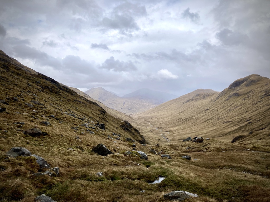
The trail continues along the jeep track for a mile or so more, at which point the guide suggests that walkers pick a random point to veer off across the heather on a vaguely north-easterly bearing. There is no trail here but it is pretty obvious where you are headed. I choose to follows the guide’s recommendation, which says to skirt the bowl of a valley at the 500m contour mark, before crossing the stream and heading directly NE up to the pass between two peaks. I regret this almost immediately. Traversing this bog/heather/peat terrain is very slow-going. I look back a couple of times and swear I see another walker behind me taking a different route, possibly another jeep trail which exists on one of my maps but not on the others. I’ll go for that one next time I am here. The guide also mentions this area as having some good camping sites. Unless you are in a bivvy, I would disagree.
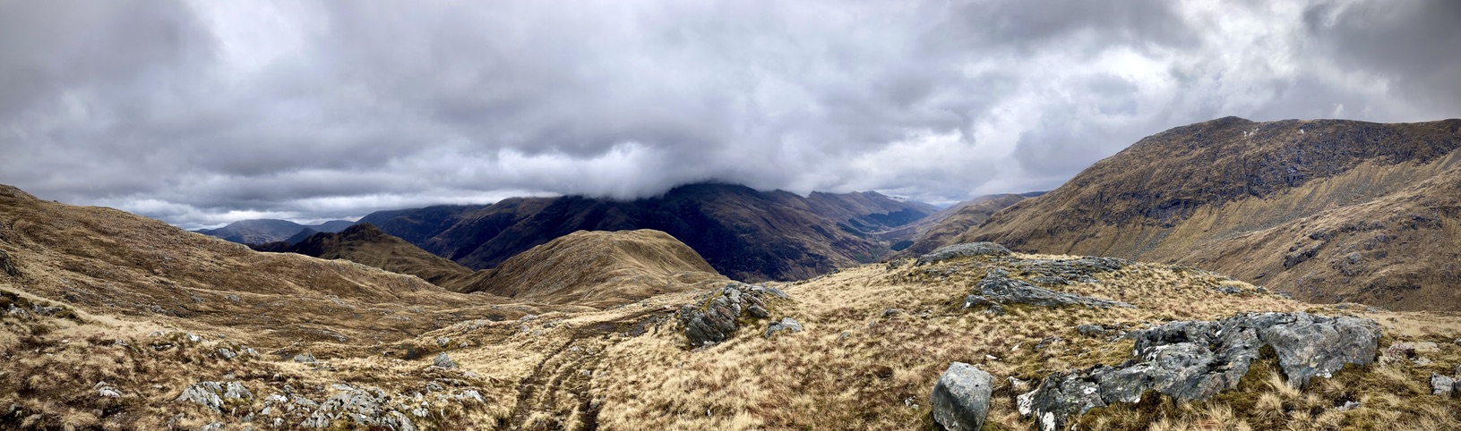
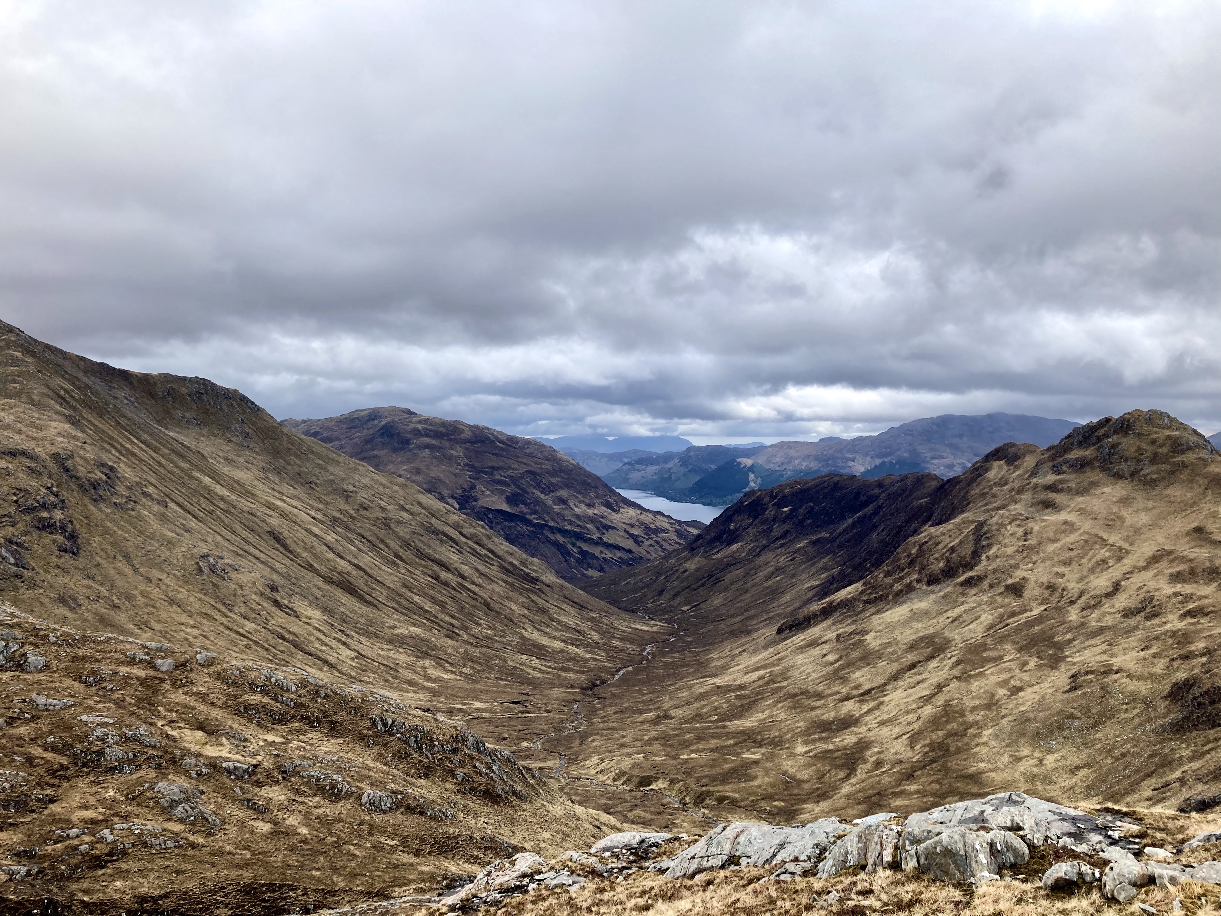
The climb up to the pass is very slow-going, my injured heel really hates going uphill, especially over such rough and unmarked ground. At the pass the view is stunning. There are snow-edged cliffs towering above to my left and right. The valley I just spent most of the morning climbing out of looks tiny now I can see all the other far off peaks framing it. Ahead of me another valley falls away and heavy low clouds cover the tops of near-black mountains which rise at its other end.
I don’t hang around as the wind is pretty much stripping the skin off my face. There is a path from this point, I know this because I have been looking forward to it. Somehow though, I completely miss it, and end up ambling down this valley even though I am clearly meant to contour it and follow a ridgeline swinging north-northwest into a different valley. I have no idea how this happened, maybe I was hypnotised by those formidable mountains directly ahead of me. Luckily I don’t get far before I notice my mistake, and I follow a slightly lower contour on a bearing which will have me meet up with the path after about half an hour.
I really enjoy this bit. I love a high ridge; 360 spectacular views and my heel is much happier on level-slightly-downhill terrain. Even with the on-and-off rain I am much faster. In the shadow of Biod An Fhitich, I leave the trail again to drop sharply down to a river which I can follow all the way to Shiel Bridge. Again this part has no path to follow but the going is easier.
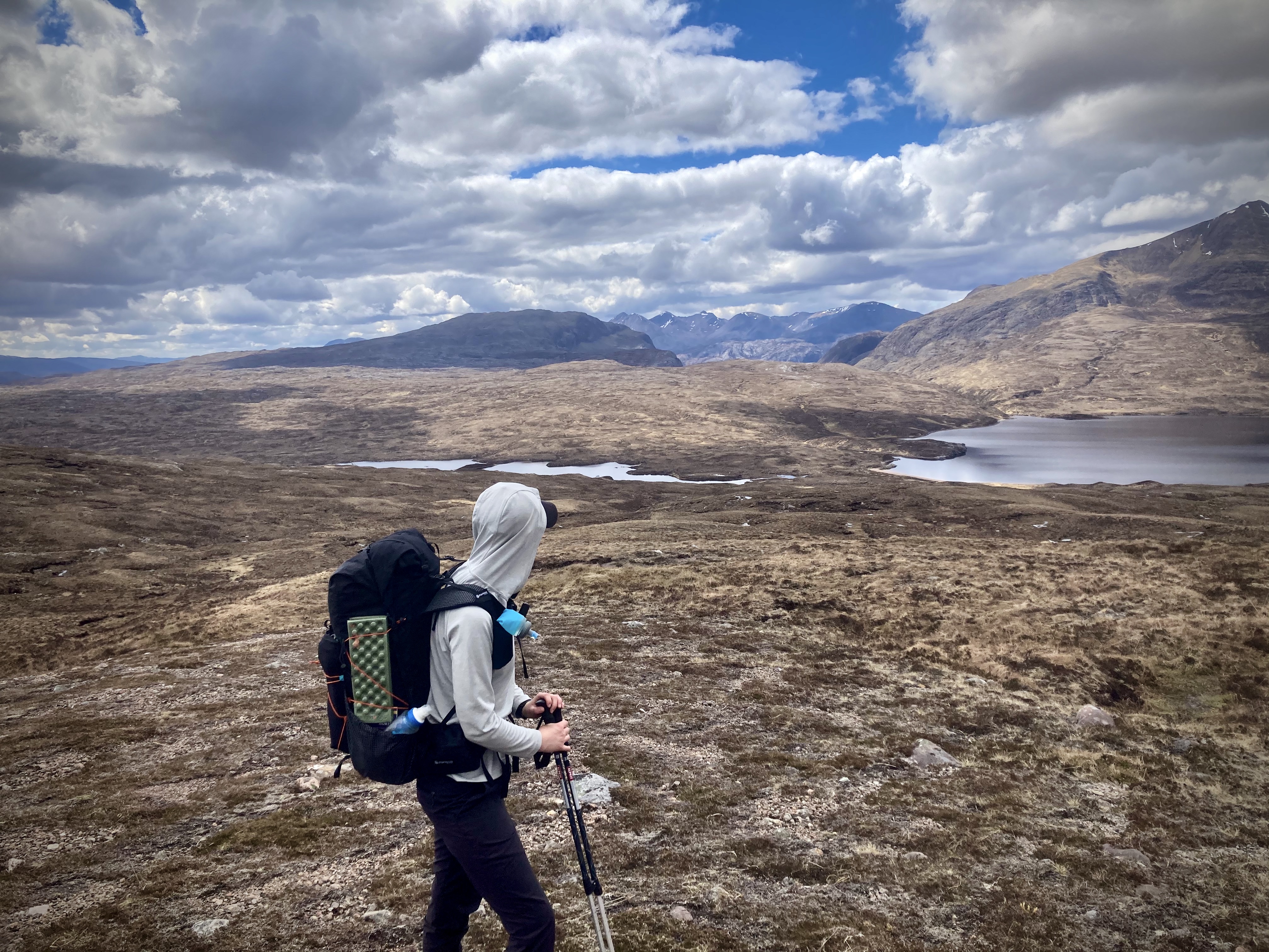
I stop for a snack break and as I am packing up to go, another walker passes to say hi and ask me about my backpack. Turns out he is curious because he has the same brand, and we quickly discover that we also have the same brand tent, quilt, pocket knife and socks. He is the first fellow ultralighter that I have met on this trail! Not only that, but we have clearly gone down the exact same paths of gear research and testing and come to near identical conclusions as to the best tools for the job.
We walk together for the next couple of miles, and chatting about all the things we have in common distracts me from the pain in my foot. I learn that he is a more committed ultralighter that I am; while we have all the same brands he went for even lighter and more minimalist options than I did. He also worked out ways to do shorter food carries, so while I started out carrying 7 days of food and plan to resupply for the following 7, he is carrying for 3 at most. With his base weight of just under 4kg and mine at just over 7kg, he can move faster than me, and indeed he is the only person I have met on trail so far who can even come close to overtaking me. (Even with an injury, I am able to outpace and overtake traditional backpackers with their standard base weights of >15kg. Really the only people we can walk with while keeping pace is each other.)
After crossing a river we join a jeep track which will take us the rest of the way to Shiel Bridge. The road aggravate my heel, so I tell my new buddy to carry on while I slow down; he is meeting someone at the highway, so there is no point waiting for me.
By the time I reach the main road my foot is screaming. (By the way that main road is deeply unpleasant, even if you aren’t limping along. Massive trucks rush by at >60mph. It is not fun.) The road follows the shore of Loch Duich into the village of Morvich. It’s very pretty, and by now the sun is fully out. But I am sulking because I am pretty sure my foot wont carry me much further. I notice I have consistent phone signal for the first time in a few days, so I call my wife to think over my options out loud. I have a tent pitch booked at the Caravan Club in Kinlochewe in a couple of days and have sent myself a resupply parcel there. We decide that I should exit the trail at Morvich and take a bus or a taxi to Kinlochewe and see how my foot feels after a couple of days off, tooling around the club site. I will be skipping what is reportedly one of the most stunning sections of the route, but I will still be on schedule to finish in my timeframe, and indeed more likely to complete at all if I allow myself to rest.
But this just is what I am telling myself to not feel so crap about it. Really I am bitterly disappointed, and annoyed that something I have been planning for and anticipating so much may end up being over.
I drag myself into a shop in Morvich, and the nice lady at the desk looks up the number of a taxi company for me. It is about 2pm, and normally I would have been just stopping for a quick lunch before carrying on for another 5 hours. I have only managed 9.3 miles today, which I suppose on an injury is both commendable and stupid.
The taxi comes quickly, and the driver is very friendly and chatty for the hour it takes to skip ahead to Kinlochewe. He also doesn’t seem to mind having a passenger who has not showered for 5 days, or he is just very polite.
At the Caravan Club site I am told by the lovely warden, Sharon, that there is no vacancy tonight, but there is space for me tomorrow. Sharon directs me to a free campsite about 2 miles north, and fetches me some ice and a wrap for my foot, telling me to rest on a bench for a while. She offers to ask some of the already-pitched tent owners would be able to budge up to make room for me, but I say I will be fine.
This is a bit of a lie and I am really dreading the walk to the site, but after a few yards on the road I stick out my thumb and a family offers to take me the rest of the way.
The Taggan campsite is just off the road, and while not remote or particularly level, the views are lovely and there are loos and a tap for drinking water, what more do you need really? I can imagine it getting a bit grotty during peak season. But at this time of year it’s just me and a couple of girls who have driven up for some car camping, so it is perfect for what I need.
I tie my quilt over the top of my tent to air it out, and settle down for the evening with a book. My cuckoo has managed to follow me from where I left the trail, and yes, I know that it is not the same cuckoo, there has never been just one cuckoo, but that is my subconscious thought before my rational brain corrects it, and I find it very comforting.
5: Zero days
The next morning I have a lie in! I vaguely recall that check-in at the club is not until 11am, so I stay in bed reading. Eventually I want a change of scene so I pack up my tent and hobble back along the way I came the afternoon before. Sadly no-one stops to give me a lift this time. There is a petrol station just outside the club entrance, and it has a very sweet cafe with an excellent menu and a well stocked shop for those who need to resupply. I stop in for some brunch before paying for my pitch and picking up the resupply package I had mailed myself from the club site office.
The most exciting things about zero days are showers, laundry and fresh food. I chose the club site for my break because it has all of these things.
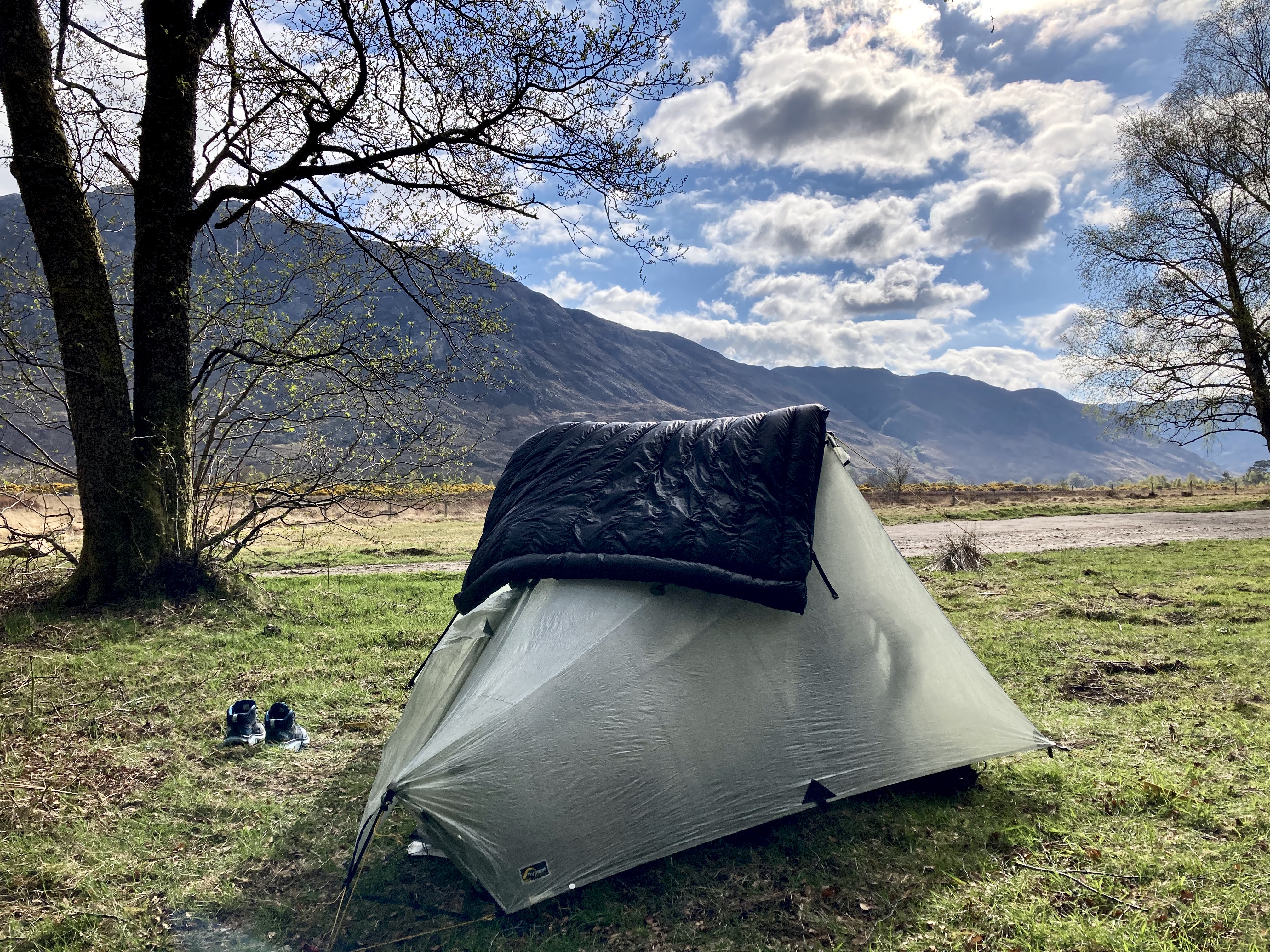
After pitching in a quiet spot, I handle laundry first. This is not easy since I only have what I am wearing, so I spend an awkward couple of hours slouching around the laundry rooms in just my waterproofs. There are plugs in the drying room, so I am able to recharge all my electronics which is lovely. After a shower and with a basket of fresh fruit and veg, I feel like a whole new person and I settle down on the grass next to my tent with my ankle elevated on a giant bag of party ice I bought from the petrol station. I watch as various tiny robins alight on my tent, hoping their sharp little claws don’t do any more damage than I have already managed to do myself.
Later in the afternoon, a group of older guys on a walking holiday together arrive and pitch up next to me. As much as I love walking alone for days in the wilderness, random conversations with strangers who share a passion is always really fun. Their two tents are large and rugged Hillebergs, and they are fascinated by my Dynema “plastic bag” tent, and all the rest of my ultralight gear. I happily give them the full tour, and show them on my maps what the Cape Wrath Trail entails. It’s a lovely evening, so after the gear shakedown we sit on the picnic benches for a tot of whiskey, and they offer to replenish my dwindling supply of ibuprofen.
The next morning I hang around the site until checkout time. There are no free pitches that evening, but my ankle is nowhere near pain-free, so I intend to have another day of lazing about. I end up spending all of it in the outdoor seating area of the petrol station cafe, reading and gradually making my way through their menu. I also perform a cull of my gear, and mail a package of things I no longer want or need back to my wife.
In the evening I repeat the trip back up the road to Taggan campsite, disappointed that 2 days of lying down and walking around barefoot has done very little to heal my foot. Again the campsite is basically empty, just me and one other pair who are car-camping.
6: Just a few more miles
I wake up early, back on my trail timetable, and hope that optimism and attitude alone will miraculously make my foot better. Unsurprisingly this does not work. Neither does cutting out the backs of my shoe with my knife (Opinel knives are fantastically sharp). It is nowhere near as bad as it had been, but as I make my way slowly back through Kinlochewe and out the other side, I realise it is all over. A guy at the petrol station tells me where I can catch a train to Inverness (the buses are worse than useless around here apparently), and I resign myself to going home.
Almost. At the fork where one direction would take me to the train, and the other would keep me on the trail, I hit a pocket of signal so I call my wife again. I hope that she will tell me I am doing the right thing, or the wrong thing. Basically I want the decision out of my hands.
As I am umm-ing and err-ing, I turn to see Adam walking up behind me. He was the fellow ultralighter I met on the trail the other day. For whatever reason, seeing him gives me the determination to keep going. (Honestly I think that I didn’t want to seem weak that I was bailing out so early, which is NOT a good reason. In fact it is a very stupid reason to keep going when your body is screaming at you to stop; who cares what some random stranger thinks? Well, apparently I did, and I also really cared what I thought and I thought that quitting after just 68 miles was crap. Adam did ask me what I would advise someone in a similar situation, and I replied that I would tell them to get off the trail, so…yeh.)
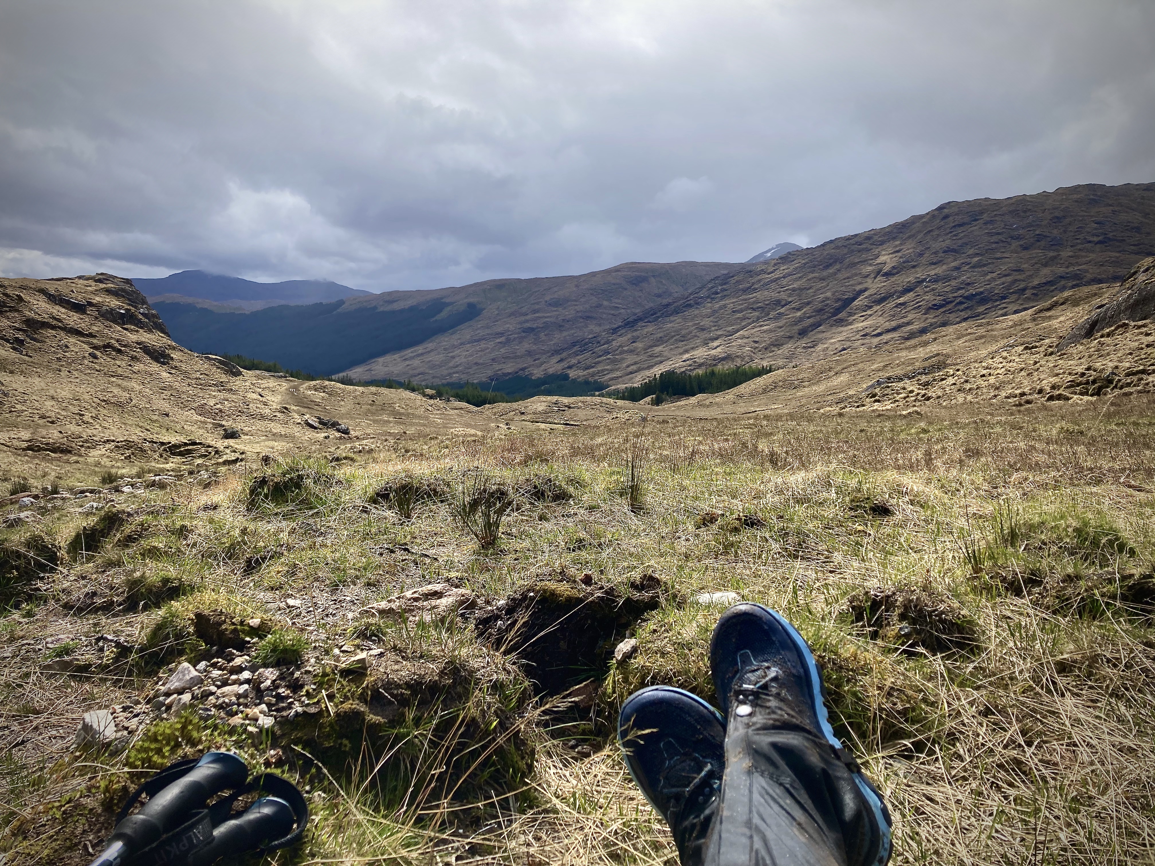
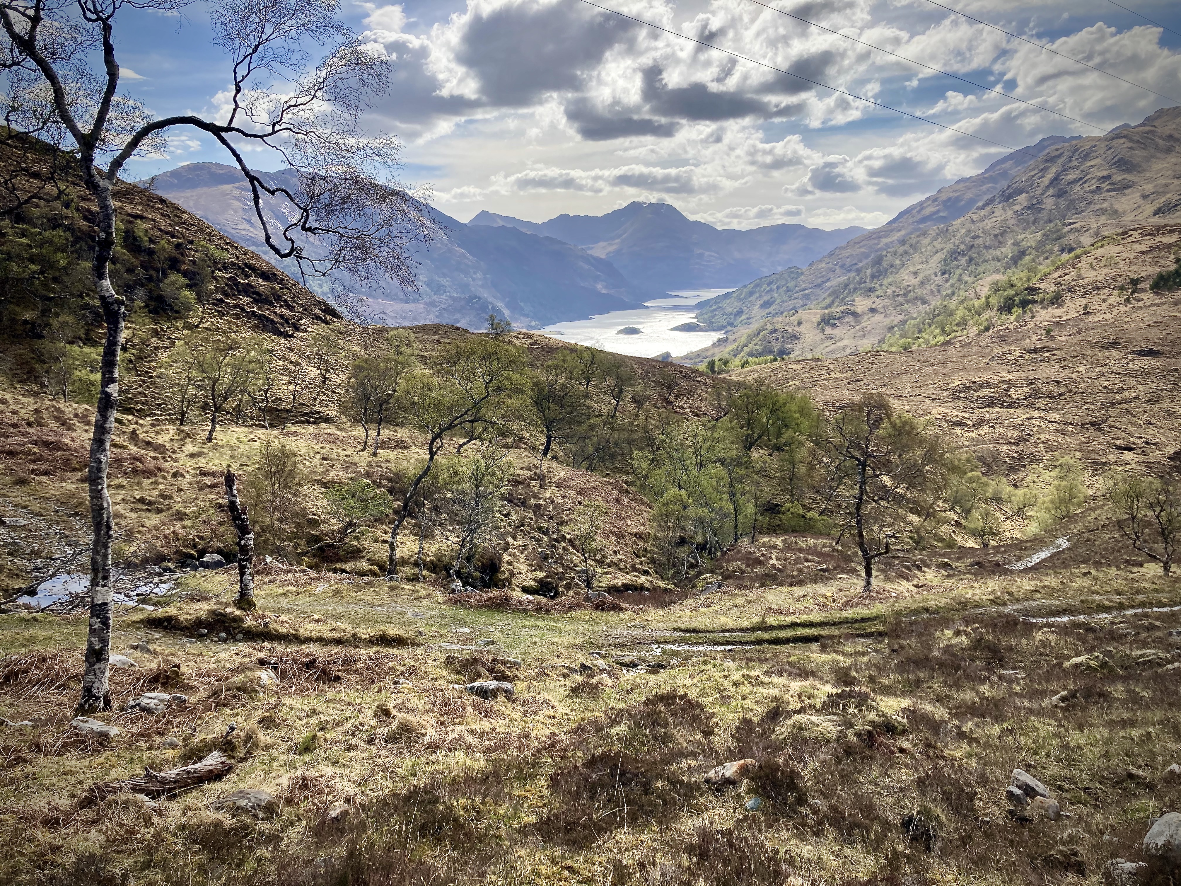
So I fall into step with him, and we pick up our conversation from a few days before. It is a stunningly clear and warm day, and the views from the top of the climb are wonderful. The jeep track we are following does not present many opportunities to stop and refill our water bottles, so when we finally come over a rise to see Lochan Fada sparkling blue below us, our lunch spot is decided.
After an hour of lounging on the beach, cooling off, we set out again to climb up to the pass between the peaks of Beinn Bheag and Sgurr Dubh. While we are only at a height of about 500 metres, lines of sight are perfectly clear in every direction, and we keep stopping to gaze at peaks rippling towards each horizon.
My cuckoo is following me still. Adam has of course been hearing his own cuckoo constantly, so we agree that there is always one following us at any time. We call this one Derek.
My foot is… coping. We keep up a steady stream of conversation, everything from gear influences to youtube channels to music tastes. We find that that there is only 8 days between us in age, which makes our overlaps in gear choices even funnier. Adam’s parents are on holiday in their caravan near Inverness, and he is planning on meeting them for a break tomorrow lunchtime at Inverlael. He offers me a lift back to Inverness on their behalf if I make the decision to call it by the time we get there. I gradually admit that it is unlikely that I will get any further than that. But I feel less crappy about it. I don’t feel great, but bailing out at 100 miles feels better than bailing out at less than 70. I still don’t actually make a decision until we get there however, I’m still hopeful.
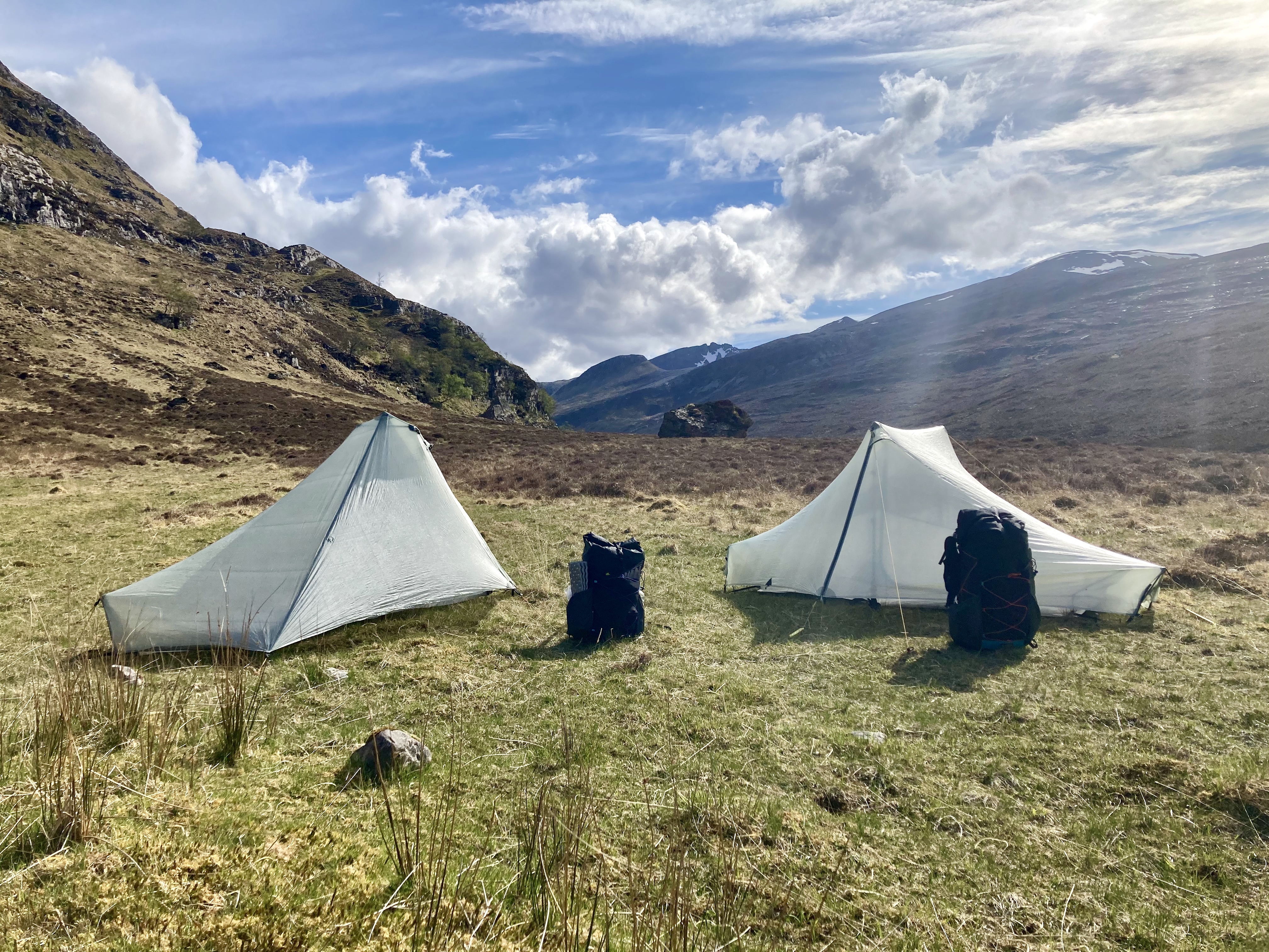
Our plan for today is to finish at Shenavall bothy on the shores of Loch Na Sealga. However, as we are following a river along a beautiful valley filled with huge dropped erratics and flanked by bare granite slopes, we meet our first southbound CWT hikers! They round a corner just as I am about to pee behind what would have been a discreet rock, which is typical. They tell us that the bothy is likely to be quite busy as they saw a bunch of cars parked on the A832, which is about 5 miles out from the bothy, perfect range for overnight hillwalkers and campers. We don’t really have to go too far today, we have already done just over 14 miles, so we decide to stop at the next place which looks nice. There are many good spots along this river, so it doesn’t take us long to spy a good site just off the trail.
It did feel a little weird. It was only 4pm. Ultralighters do not stop walking at 4pm. After couple of minutes standing about talking about how weird it feels to be pitching in broad daylight, we eventually get down to it, and set up our matching tents. Derek is there, judging us, but we ignore him.
As evening falls we drink some whiskey, and watch as mist rolls down off the hills in thick sheets towards us.
7: Game over
The next morning is equally bright and hot. We leave early, and a jeep track carries us gently out of the valley to a plateaux. After about 5 miles, we drop down from the other side and are welcomed by the sight of a new range of mountains stretching north, interspersed with glittering lochans and sea lochs.
We drop down into a valley, passing some cows and a guy coming the other way clearly out for a hike while wearing a suit, of all things, and find a nicely shaded patch of woodland for some lunch.
The climb out of the valley is steep, airless and we are boiling. We stop basically every 10 paces, muttering about how we better find a decent stream soon. Finally we do. The stream is wide and cool and fast flowing, cutting across the trail with waterfalls. Aside from the bones which clearly make up an entire sheep’s skeleton it was perfect. It is so hot that we decide to risk it, wading upstream until the last vertebra is out of sight. The bones are picked clean anyway, so any bacteria are likely long-gone. We stand with our heads under the falls and refill our bottles, Adam remembering too late that he broke his water filter a few days ago.
I tease him about bone juice as we continue over the plateaux. We deliberately “fall” into every river and stream we cross as we seem to be in a totally different country from where we started the trail. Eventually we see the waters of Loch Broom below us. It is astonishingly blue in the sunlight.
The descent down to the loch is savagely steep, and both pair of knees are soon deeply unhappy. The drop is about 400 metres across a distance of 2 miles, and several times we joke that it would be less painful to simply roll or slide down. We imagine how vicious it must be in poor weather. It takes us a long time, even in perfect conditions. Derek joins us for this bit, and he is quite insistent, so we use talking back to him as a distraction from the cartilage-crunching monotony. When we are just shy of the bottom we meet some mountain bikers coming the other way, carrying their rides. We warn them of the climb and wish them luck. When they are past we say that you couldn’t pay us to carry a bike up that.
By the time we hit the road (another horrible one, with fast trucks and little safe space to walk) I know I have reached the end. Today was my final 15 miles. The last couple of days I know have been borrowed time, and that I can’t push my luck anymore. I know that every step has been causing more damage, and unless I stop, the injury will become a permanent fixture of my life, which means no coming back to try again.
We follow the road to the carpark from which the trail continues, and sit down to wait for Adam’s parents, who are happy to give a lift to the stray their son has picked up. We call goodbye to Derek, and head back to civilisation.
They drop me near to the central bus terminal in Inverness, and I thank them for their kindness, and say goodbye to Adam. He promises to text me when he reaches the end, with a selfie in front of the Cape Wrath lighthouse.
A couple of hours later I am back at my car in Fort William, feeling strangely deflated and unreal. The weather has turned horrible, so I decide to treat myself to a room at the Premier Inn, rather than finding a campsite. This is probably sensible, since I have a 10 hour drive the next day, and it finally really hits me that I will be driving home tomorrow.
I am disappointed, but I know I made the right decision. I will do the trail next year, and I will have the learnings of this year to back me up. I walked 100 miles across stunning country, and next year I will walk 240.
If you are planning on getting into wild camping or being outdoors more (or you already are out there, awesome!), take care to follow Leave No Trace rules to keep the wilderness wild.
I will update the blog with some details of how to walk the CWT, but for now here is just my gear list and a map of the route. At some point I will also do reviews of the gear I love.